| |
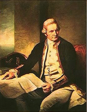
Cook |
 |
A Navigational Pioneer |
The Pacific remained largely unexplored and uncharted until the three voyages of discovery undertaken by James Cook from 1768 to 1779. Cook's first voyage commenced on 21 July 1768 when he sailed out of London on HMS Endeavour. This voyage lasted three years but because of the intransigence of the Board of Longitude, he was not able to carry one of Harrison's chronometers, although, by this time its effectiveness at determining longitude had been proven and it would have clearly been an invaluable aid to his navigation. Instead, Cook had to rely on calculating lunar distances once he had reached Cape Horn. His latitude was fair, being wrong by only one mile, but his estimate of longitude erred by a degree, which at that latitude was about 40 miles (Berthon and Robinson, 1991:125).
Cook's first destination wasTahiti, discovered in 1767 by Wallis, but without the benefit of knowing longitude he had to rely on the time honoured method of running down its known latitude for hundreds of miles until the island was finally sighted. At Tahiti, Cook, under instruction from the Royal Society of Britain was to view the transit of the planet Venus across the sun’s face which was predicted for June 3 1769.
After Tahiti, Cook completed a 2400 mile circumnavigation of the waters around New Zealand, completing a map of its coast-line within six months. Having completed the survey Cook planned to return to Europe past Cape Horn between latitudes 40 degrees and 60 degrees. His aim was to establish whether the legendary Southern Continent would really be in the way. However, he changed his plans and instead sailed west and eventually sighted the south-east corner of Australia. It was decided that this could not be Terra Australis because it was barren and did not fit the popular image. Cook’s exploration of the east coast produced charts with named features and latitude (Berthon and Robinson, 1991:127 and Beaglehole, 1974:50-52). He himself seems to have used existing Portuguese charts, for instance in making for the Endeavour River for repairs after the Endeavour was holed. Twelve months later Cook returned to England. Soon plans for a second trip were underway.
In July 1772 HMS Resolution and Adventure sailed from Plymouth under Cook. This time, Kendall's copy of Harrison's No.4 Chronometer was on board. "It gave Cook the confidence to begin the accurate mapping of the Pacific." (Berthon and Robinson, 1991:128). On this voyage Cook aimed to explore Antarctic regions, circumnavigate the globe at the higher southern latitudes and explore the Pacific in a thorough search for wealth in the South Seas that Cook might match the Spanish colonies. After leaving Tahiti, Cook proceeded with the Admiralty’s instructions to look for potential wealth for the Crown. He circumnavigated New Zealand, charted its 2 400 miles of coast and "took possession" of both islands. This occupied six months. Instead of returning to Europe via Cape Horn, as originally envisaged he decided to return via the east coast of New Holland which the Portuguese had mapped but not desired (Berthon and Robinson, 1991:127).
It should be emphasised that the first explorer to chart new areas, as Cook was doing, was literally establishing the first recorded path among the observable but hitherto unrecorded features. He did not know "where" he was in relation to known landmarks, although after Harrison he could place himself on the surface of the globe, with measured latitude and longitude. A traveller with a chart could make for a named destination, as Cook himself did in returning to New Zealand. Proper use of instruments and mathematics for latitude, and proper functioning of Mr Harrison’s mechanical engine for longitude, ensured that he got there.
Harrison’s chronometer enabled Cook to complete detailed charts with an accuracy that was previously unknown. It served to fix his place in history as a great navigator as Berthon and Robinson, (1991:131) observe: "[Cook’s] chief memorial is the modern conception of the Pacific, derived from his superbly accurate charts, in which every island and every coastline [that he sighted] had its latitude and longitude properly fixed for the first time through Cook’s care and Harrison’s chronometer. After Cook, no navigator could have an excuse for failing to find a Pacific island that Cook had visited or for being wrecked on a coastline appearing from nowhere."

 |
 |
 |
